Most travellers have heard the claim “Can the Great Barrier Reef be seen from space?” tossed around like a footy at a Sunday barbie, so I figured it was time to put the debate to bed. As someone who’s spent decades guiding people through the Great Barrier Reef Marine Park — a UNESCO World Heritage Site and one of the largest coral reef ecosystems on Earth — I’ve seen firsthand how huge this reef system really is. Think of this as a yarn by the billy: the science, the landscapes, the coral reefs and coral cays below, and the big question astronauts ask as they orbit overhead on the International Space Station.
The Truth Behind The Space Story

You’ve probably heard someone swear blind that astronauts can spot the reef with the naked eye. It’s partly true — but not in the dramatic, comic-book way the legend suggests. From low Earth orbit, astronauts like Kjell Lindgren have photographed the reef’s pale blues and sweeping outer barrier reefs using a Nikon D4 and a 1150mm lens through the Earth Science and Remote Sensing Unit at the Johnson Space Centre. They aren’t seeing coral polyps, hard corals, soft corals, or coral gardens — just large-scale colour contrast shaped by coral growth and shallow lagoon systems.
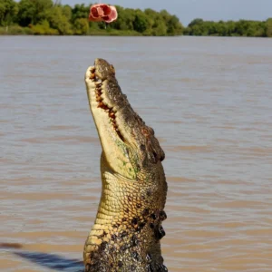
When I first flew over the reef on a low scenic run out of Cairns, I realised how much the Coral Sea plays tricks on your eyes. Light, glare, tide height, and cloud cover all shift the visibility — whether you’re choppering over Agincourt Reef, diving North West Island Reef, or looking down from the ISS.
How Astronauts Really See the Sea Below

If you picture astronauts peering down and spotting individual coral formations, tropical fish, or tiny bommies like a snorkeller drifting over a platform reef, best lower your expectations. What they can see are the huge shapes: the continental shelf edges, the pale contours of coral islands, the outlines of coral cays, shallow seagrass beds, and the shimmering turquoise areas that define the broader reef system.
Why Visibility Changes

You’ll want to know this: visibility from orbit depends on conditions far beyond the reef’s massive size.
- Water clarity — tied to Reef Water Quality, runoff, and sediment from river catchments
- Sun angle and cloud cover — critical for ISS photography and Envisat satellite data from the European Space Agency
- Depth variation — shallow coral reefs, seagrass estuaries, and lagoon systems reflect more light
- Climate change — mass bleaching events alter how coral polyps reflect sunlight
None of this makes the reef any less extraordinary. It simply means the old “visible from space” line has more nuance than the postcards suggest.
Digging Into The Numbers (Because Scale Matters)
The Great Barrier Reef Marine Park isn’t just big — it’s colossal. Stretching over the Coral Sea and spanning thousands of coral reefs, coral cays, fringing reefs, and seagrass beds, the system forms the world’s largest UNESCO World Heritage Area. Below are figures commonly referenced by the Great Barrier Reef Marine Park Authority, Reef Authority, and Australian Institute of Marine Science (values may shift as monitoring continues under the Reef 2050 Plan and Reef 2050 Long-Term Sustainability Plan):
| Feature | Approximate Size / Count | Why It Matters |
|---|---|---|
| Total Length | ~2,300 km | A reef chain visible in broad strokes from space |
| Number Of Reefs | 3,000+ | Includes fringing reefs, patch reefs, and platform reefs |
| Coral Cays & Islands | ~900 | Shallow lagoon colours show clearly in satellite imagery |
| Total Area | ~344,400 km² | A footprint bigger than Italy — visible even from ISS orbit |
A structure this massive leaves its signature on the Coral Sea, but satellites aren’t spotting manta rays, marine turtles, humpback whales or Black Marlin — just the big shapes carved over millennia.
What You See From Earth (And Why It Matters For Space)

Standing on the esplanade in Cairns, Townsville, or the Whitsunday Islands, you won’t see the reef at all — it sits 30–100 kilometres offshore along the continental shelf. But take a scenic flight or join a liveaboard dive trip out to Agincourt Reef or other outer barrier reefs, and the entire coral reef ecosystem lights up beneath you in swirling blues and greens.
A Traveller Tip From The Field
If you want your own “space view” without the ISS commute:
- Fly over shallow coral islands and cays during midday sun
- Avoid heavy runoff weeks that reduce Reef Water Quality
- Choose routes over Agincourt Reef, North West Island Reef, or the Whitsundays
- Skip photographing through commercial jet windows — the glare is rough as guts
I’ve done my fair share of scenic flights over the Marine Park, and the first time I saw coral gardens, coral cays, and seagrass beds from above, I understood why astronauts mention the colours with such awe.
How Satellites Map Our Oceans
Remote sensing is the quiet engine of reef conservation. Agencies like the Queensland Government, Reef Trust, Reef Authority, Australian Institute of Marine Science, and WWF Oceans Practice rely on ISS imagery and Envisat satellite data to track environmental change across the marine protected area.
What Satellites Detect
They’re analysing:
- Coral bleaching and mass bleaching events
- Ocean acidification linked to fossil fuels
- Crown-of-thorns starfish outbreaks
- Marine debris movement
- Seagrass bed health and recovery
- Species die-off after heatwaves
- Marine wildlife habitat shifts
No one’s spotting marine animals like sea turtles, tropical fish, or manta rays in real time — but the data guides crucial Reef Management decisions.
Why This Matters For Travellers
Satellite research drives:
- Zoning under the Great Barrier Reef Marine Park Act 1975
- Habitat Protection Zones, Marine National Parks, and Conservation Parks
- Responsible Scuba Diving Site Planning
- Reef 2050 Long-Term Sustainability Plan implementation
- Monitoring ecosystem services that keep marine species alive
It’s the behind-the-scenes science that protects everything from coral growth to spawning cycles.
A Quick Reality Check About The “Space Myth”

Let’s keep things fair dinkum:
- Yes, the reef can be seen from space under ideal conditions.
- No, astronauts aren’t spotting coral polyps, reef fish or soft corals.
- Yes, the reef appears as a massive marine wildlife habitat across the Coral Sea.
- No, space-based visibility doesn’t reveal reef health, coral bleaching severity, or climate change impacts.
There’s no substitute for seeing the reef up close — drifting over coral gardens with tropical fish weaving through bommies is a world away from the ISS view.
Best Ways To Experience The Reef
Whether you’re a diver chasing manta rays or a snorkeller hoping to spot sea turtles gliding over soft corals, the best experiences still happen on the water.
My Go-To Recommendations
- Day trips from Cairns or Port Douglas
- Liveaboard dive trips to remote coral islands and patch reef systems
- Lady Elliot Island and Heron Island for pristine coral cays
- Scenic flights for the astronaut-style overview
- And always follow the guidance of Traditional Custodians, Traditional Owners, and Torres Strait Islander communities regarding access and cultural respect.
If you’re planning a trip north and want solid reef advice, Great Barrier Reef Tours has up-to-date notes on seasonal conditions and the best reef sections for visibility.
FAQ
Is the Great Barrier Reef visible from space without equipment?
Yes — astronauts on the International Space Station can see its broad shapes, especially across the Coral Sea.
Can satellites detect coral bleaching?
Absolutely. Envisat, Landsat and ISS imagery help track bleaching and ocean acidification patterns.
Why can’t you see the reef from the beach?
The reef sits far offshore along the continental shelf, with inshore waters too cloudy to reveal the system from land.
Is the Great Barrier Reef the only natural feature visible from space?
No — deserts, coastlines, volcanoes and ice shelves also show up clearly.
Does visibility from space indicate reef health?
Not at all. Reef health is assessed through water quality, coral bleaching severity, changes in marine wildlife, and Reef 2050 Plan monitoring.